Tuesday, September 13, 2011

Maryland BayStat - Fighting Crime, Restoring Ecosystems, and Connecting People

William Nuttle, Organizer for CERF 2011 Synthesis Sessions
wnuttle@eco-hydrology.com

I am just back from attending the EMECS conference, where I saw perhaps the best presentation ever on ecosystem restoration. For 40 minutes, the governor of Maryland, Martin O’Malley, led his audience on a sure-footed tour through the intricacies of ecosystem management in the Chesapeake Bay and its watershed. It was a winding tour that somehow, by the end, still managed to bring home the significance to the average citizen of what is being done. But what made the presentation truly remarkable is that O’Malley opened his presentation on the topic of crime and how a systematic approach to fighting crime prepared him for the task of restoring the Chesapeake Bay.


Before becoming governor, O’Malley served two terms as mayor of Baltimore. When he entered office in 2000 Baltimore’s murder rate was five times the rate in New York City. During the 1990s New York served as a proving ground for systematic approach to fighting crime that was credited with reducing the crime rate. The approach, known as CompStat, implements concepts of quality control and systems management borrowed from business and industry. O’Malley brought a similar program to Baltimore and expanded it into a general approach for management and accountability in government. 


O’Malley’s program for restoring the Chesapeake Bay, established in 2007, goes by the name of BayStat. It’s touted as a “tool designed to assess, coordinate and target Maryland’s Bay restoration programs, and to inform our citizens on progress.” Underlying this approach is an extensive program of environmental monitoring, modeling, and analysis by state agencies and academic scientists. Managers meet frequently with scientists and political leaders to assess progress toward restoration goals and adapt management actions based on results obtained. 


One is tempted to say that there is really nothing new to BayStat. There are direct parallels between elements of O’Malley’s program and elements of ecosystem-based management and adaptive management as described in numerous reports by the National Research Council, Council for Environmental Quality, and large environmental NGOs. Quantitative ecosystem indicators, performance measures, restoration targets, and a report card – they are all here.

What makes Maryland's BayStat so special?

Well, for one thing, it is remarkable to see a political leader take the reins and offer a reasoned assessment of current conditions and progress toward restoration, including a summary analysis of the data on half a dozen indicators. This shows a reassuring commitment at the political level. But there is a bit of magic at work here as well. Somehow, in the politician’s hands the bare concepts behind ecosystem-based management, which lie inert on the pages of so many technical reports, become a means to connect people with each other and people with the ecosystems in which they live. Maybe, the magic is in the ability to articulate what  fighting crime and restoring ecosystems have in common.

The information in this post relates to Topic 3: Management applications and Topic 6: Management challenges of the CERF 2011 synthesis sessions.


Monday, August 29, 2011

Who, What, When, Why and How of Louisiana's 2012 Coastal Master Plan

Alaina Owens (Brown and Caldwell)

Who: The plan is being developed by the Louisiana Coastal Protection and Restoration Authority. In all, over 100 people are involved in the planning effort. The state has established a variety of ways for government staff, industry representatives, non governmental organizations, members of academia, citizens, and other stakeholders to participate in the process.

Levee/floodwall construction


What: The 2012 Master Plan will offer a comprehensive approach to coastal restoration and risk reduction in coastal Louisiana. The Plan focuses on the following five overarching objectives:

  1. Reduce economic losses from storm based flooding to residential, public, industrial, and commercial infrastructure.
  2. Promote a sustainable coastal ecosystem by harnessing the processes of the natural system.
  3. Provide habitats suitable to support an array of commercial and recreational activities coast-wide.
  4. Sustain, to the extent practicable, the unique cultural heritage of coastal Louisiana by protecting historic properties and traditional living cultures and their ties and relationships to the natural environment.
  5. Promote a viable working coast to support regionally and nationally important business and industry.

Barrier island restoration


When: The plan will be submitted to the Louisiana State Legislature for approval in the spring of 2012. By legislative mandate, the plan must be updated every five years so the state can respond to changes on the ground as well as innovations in science, engineering, and policy. Louisiana’s 2012 Coastal Master Plan is the second of what will be an ongoing series of master plans, each one improving on work done before.

Marsh creation


Why: The wetlands of coastal Louisiana help protect communities and critical oil and gas infrastructure from storm surge, support waterborne commerce for the nation, and provide a substantial portion of the nation’s commercial fisheries landings. The coast’s expanse of natural habitats makes it one of the nation’s most unique and valuable landscapes. Unfortunately, Louisiana’s wetlands are being lost at an alarming rate, with an estimated loss of nearly 2,000 square miles since the 1930s.

How: The 2012 Coastal Master Plan is grounded in a coastal “vision.” The vision specifies levels of flood risk reduction for communities and targets for ecosystem services across the coast. A suite of seven predictive models is being used to predict how far various restoration and/or protection projects can move the state toward achieving its vision. Model output, combined with a set of decision criteria (factors that reflect what is important to the state), feed a decision support tool that compares the effects of projects and groups of projects. This information will help state decision makers identify projects that provide the most benefit.

Example project types include levee / floodwall construction, barrier island restoration, and marsh creation. River diversions, hydrologic restoration, shoreline protection and bank stabilization projects are also being analyzed as part of the 2012 Master Plan update.

The use of predictive models in formulating Louisiana's coastal Master Plans relates to Topic 5: Dynamic ecosystems to be discussed during the Synthesis Sessions at CERF 2011.  You can hear more on the specific topic of this post in session SCI-010 - Challenges and Innovative Methods Integrating Science and Coastal Decision Making.

For more information on the Louisiana Master Plan go to www.coastalmasterplan.la.gov, or email – masterplan@la.gov.

Monday, August 15, 2011

Coastal Scientists and Managers in a Three-legged Race to Set Nutrient Criteria

William Nuttle, Organizer for CERF 2011 Synthesis Sessions
wnuttle@eco-hydrology.com


In the ideal partnership between coastal science and management, the job of scientists is to discover underlying causes and describe possible solutions to a problem, and the managers’ job is to implement the solution. This requires scientists and managers coordinate their actions, much like teammates in a three-legged race. So, if one partner makes a change in direction, then it’s bound affect the other’s game.

The US EPA is the lead management agency in the effort to combat the growing “dead zone” the northern Gulf of Mexico. Nutrients from farm fields in Midwestern states, carried into the Gulf by the Mississippi River, feed an annual algal bloom in near shore shelf waters. The death and decay of bloom organisms depletes oxygen in the stratified bottom waters over a very large area of the coast.

The solution to this all too familiar problem of coastal eutrophication is to reduce the amount of nutrients carried to the Gulf by the Mississippi. Managers rely on scientists to provide data and analyses needed to establish defensible nutrient concentration thresholds and loading rates that protect against the negative effects of eutrophication. The key to success is to be able to link the problems caused by excess nutrients in coastal waters directly to the various processes that introduce nutrients into the river up in the watershed.

Scientists and managers have already run this three-legged race in the Chesapeake Bay and its watershed. At the end of last year, December 29, 2010, EPA established a “pollution diet” for the District of Columbia, and large sections of Delaware, Maryland, New York and Pennsylvania. These limits were established across the entire watershed of the bay, all at once, based on state-of-the-art modeling tools, extensive monitoring data, and peer-reviewed science.

However, EPA is taking a different direction in addressing the problem of coastal eutrophication in the northern Gulf of Mexico. Last month, July 2011, EPA reiterated its intent to follow a proposed Framework for State Nutrient Reductions in setting numeric nutrient criteria for the Mississippi River watershed. The proposed framework lays out a states-based approach, instead of the watershed-based approach used for the Chesapeake Bay. The first step is to establish, separately for each of the 31 states in Mississippi-Atchafalaya River Basin, priorities for nutrient reductions among hydrologic basins within the state.

What does the decision by EPA mean for the scientists who will be called on to provide the essential information needed to establish these criteria? How can water managers in Missouri factor in the impacts of eutrophication in coastal Louisiana when setting water quality criteria for rivers and streams in their state? What data will be required and what approach can be taken to perform such an analysis. Will water managers in Kansas use the same approach or a different one that they might prefer? Who can say?

These questions relate to Topic 3: Management applications and Topic 6: Management problems to be discussed during the Synthesis Sessions at CERF 2011.


Figure credit: http://www.georgekrevskygallery.com/dynamic/artwork_detail.asp?ArtworkID=651

Friday, August 5, 2011

PCAST Recommends National Ecosystem Assessments, Better Science

William Nuttle, Organizer for CERF 2011 Synthesis Sessions
wnuttle@eco-hydrology.com


In July, advisors to the President called for the US to begin tracking the state of its ecosystems and evaluating the economic benefits they provide. This report by the President's Council of Advisors on Science and Technology recommends a quadrennial, across the board assessment of the state of US ecosystems and the services they provide.

Right now, the US federal government spends about $10 Billion per year on ecosystem restoration and preservation. This figure does not include investments made by state and local governments and by private groups. One of the concerns raised by the report is that data from government-supported environmental monitoring programs are not available to assess the efficacy of these investments, or indeed whether more work is needed

“The Nation has an urgent need for more complete monitoring systems in order to inform policy, as a basis for development of predictive capabilities, and to address issues of compliance, assessment, and management.” The committee recommends that the federal government conduct a comprehensive assessment of the nation’s ecosystems every four years, the Quadrennial EcoSystems Trends (QuEST) Assessment.

Managing the data in such an effort would be challenging, and this requires attention to data accessibility and the innovative use of information technologies. Other challenges relate to the science underlying ecosystem monitoring and analysis. Questions that must be addressed include:
  1. “Are current modeling methods adequate to predict the consequences of human-ecosystem dynamics for biodiversity preservation, for ecosystem services, and for biosecurity? 
  2. “What is the scope for using socio-economic data in modeling anthropogenic environmental change? 
  3. “How can existing monitoring systems be augmented to include such data?” 

The recommendations lack the force of regulation or policy. But they do indicate recognition at high levels of need for regular reporting on the nation’s ecological health and, implicitly, for the science underlying ecological monitoring and assessment. Details remain, but implementation must keep in sight that national ecological assets are not simply numbers in a ledger; they are where people live and the resources we depend on.

The information in this post relates to Topics 1 and 5 of the CERF 2011 synthesis sessions.

Figure credit: http://www.nefsc.noaa.gov/ecosys/background.html

Sunday, July 31, 2011

Science in the R.I. Special Area Management Plan

William Nuttle, Organizer for CERF 2011 Synthesis Sessions
wnuttle@eco-hydrology.com


Last week NOAA Administrator Jane Lubchenco joined a host of political leaders to announce Rhode Island’s Ocean Special Area Management Plan (Ocean SAMP). This is a big deal because NOAA touts Ocean SAMP as the template for implementing coastal and marine spatial planning (CMSP) in the US. CMSP is defined as a comprehensive, adaptive, integrated, ecosystem-based, and transparent spatial planning process, based on sound science. The push to adopt CMSP is international in scope.

In practical terms, CMSP provides a process for analyzing current and anticipated uses of estuaries and coastal waters to determine how to realize commercial, recreational and environmental goals. The motivation behind Ocean SAMP was to get out in front of issues related to installing a couple hundred wind turbines to generate electric power off the Rhode Island coast. The plan encompasses an area of approximately 1,467 square miles, including portions of Block Island Sound, Rhode Island Sound, and the Atlantic Ocean.

If this marks the beginning of the future for coastal planning and management, then widespread implementation of CMSP will affect how coastal and estuarine research is supported and organized in coming years. So, what insights does the Ocean SAMP report provide into what may be the future of our science?

Plan Based on Best Available Information
The Ocean SAMP uses the “best available science” to build a comprehensive understanding of the area’s ecosystems. Through the multi-year process of developing the plan, a Science Advisory Task Force provided expertise and input on issues of science and research. New research was commissioned, and the results of this research are reported in the plan document and in a series of appendices to the main report. A chapter in the main body of the report titled “Ecology of the Ocean SAMP” describes the regional ecosystem.  However, authors opted for using a more traditional, natural history framework;  topics proceed hierarchically from geology and meteorology through physical oceanography, chemical oceanography, and on to biological oceanography.

Coastal and Estuarine Science Moving Forward
Part of the vision for CMSP is the implementation of ecosystem based management of estuarine and coastal areas, thus the attention to thoroughly documenting the ecosystem of the Ocean SAMP at its outset. Ecosystem based management also means committing to conduct ecosystem research, monitoring and analysis on a continual basis as an integral part of management activities in the region. Objectives for the (future?) Ocean SAMP Science Research Agenda are to:
  1. Continue to learn about Rhode Island’s offshore natural resources and human activities; 
  2. Better understand the potential effects of future development and other human impacts; and 
  3. Increase Rhode Island’s understanding of the projected impacts of global climate change. 
Future plans are to convene an advisory group with scientists from partner federal and state agencies, environmental organizations, and users of the Ocean SAMP area. Presumably, it will be up to this group to articulate critical details of the research agenda by identifying data gaps, short- and long-term research priorities, potential partners, and potential funding sources.

The information in this post relates to Topic 6: Management applications of the CERF 2011 synthesis sessions.  I'd like to hear more from anyone who has been directly involved in the development of the Ocean SAMP.

Thursday, July 28, 2011

Case Studies of Coastal Science and Management at Regional Scale

William Nuttle, Organizer for CERF 2011 Synthesis Sessions
wnuttle@eco-hydrology.com

The movement toward coordinated management of coastal and estuarine resources at the regional scale will require greater investment in large-scale ecosystem research capable of providing information needed by managers.  On May 18-19, 2009, NOAA’s Center for Sponsored Coastal Ocean Research convened a workshop to examine existing regional-scale ecosystem research and identify practices that lead to research results with direct management relevance and impact.  This workshop assembled over fifty experts on coastal ecosystem science, management and policy representing all coastal regions of the US, including the Great Lakes, and the republic of Palau.  

Location of 8 regional applied ecosystem research case studies

The eight case studies compiled for discussion at the workshop represent a wide variety of physical and ecological contexts; these include the Great Lakes (8 - Lake Erie), a river-dominated coast (4 - northern Gulf of Mexico), tropical lagoon systems (6 - Micronesia and 3 - South Florida), and coastal ocean systems (5 - California coast, 7 - Bering Sea, 2 - Gulf of Maine, and the 1 - Northwest Atlantic). Case studies were chosen to examine a variety of issues, funding, and participation involved in regional ecosystem research. Each case study provided a unique perspective on planning and implementation of regional ecosystem research from the point-of-view of both scientists and managers.

In all cases, the success of the applied ecosystem research depends on the following essential program support elements:

Overarching goals for management of the regional ecosystem articulated by the cooperating agencies and stakeholders and informed by a shared vision of the ecosystem based in science;

Regional coordination among cooperating management agencies and between managers and research scientists;

Clear project objectives that connect results of research and monitoring to the specific programs and mandates of the cooperating management agencies;

An open process for sharing information between agencies and communicating results of research to managers and stakeholders; and

Regular reporting of progress made toward the over arching ecosystem goals based on quantitative indicators based on ecosystem research and monitoring.

The information in this post relates to Topic 3: Management applications of the CERF 2011 synthesis sessions.  Go here for more information about these case studies from the IAN Program of the University of Maryland.

Wednesday, July 27, 2011

Topics Set for Synthesis Sessions at CERF 2011

William Nuttle, Organizer for CERF 2011 Synthesis Sessions
wnuttle@eco-hydrology.com

Q: How far can you wander into a jungle?
A: Half way.

This riddle came to mind during the June meeting of the Program Committee.  For three days, in Daytona Beach, the committee labored to find our way through the thicket of topics submitted for presentation at the CERF 2011conference in November.  On more than one occasion I found myself wandering off course, distracted reading an abstract that seemed ripe for immediate consumption.  Such were the hazards of this work, but the committee valiantly soldiered on. By the end of day two we finally penetrated to the heart of the jungle and started on the journey back out.  

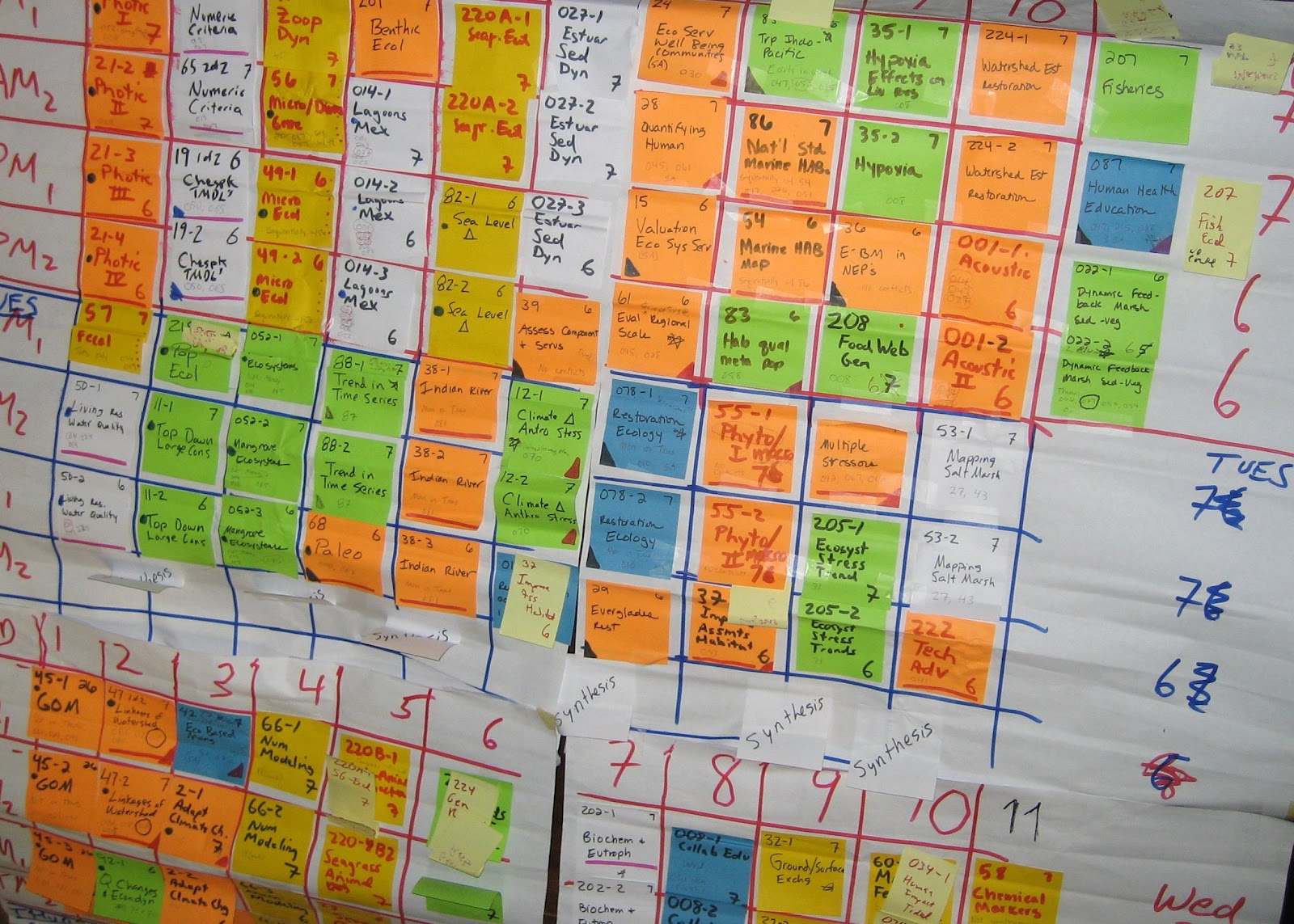
Initial draft of CERF 2011 program - at the heart of the jungle

We have made good progress since then.  The conference program is now final.  Presenters soon will learn their assigned time and location; possibly these emails have already gone out.  And, we have set some markers - the topics for discussion during the synthesis sessions - intended to aid those who will follow us into this jungle during the CERF 2011 meeting in November.

Synthesis at CERF 2011
The synthesis sessions planned for CERF 2011 will examine how integrated ecosystem assessment (IEA) can be used to help societies, estuaries and coasts adapt to change.  Integrated ecosystem assessment is a tool that scientists and managers can use to gather and synthesize the scientific information needed to support an ecosystem-based approach to management. 

Topics identified for discussion will capture the latest findings, to be presented at the conference, and knit together ideas developed separately in concurrent sessions. The synthesis sessions will address six topics altogether.  Three will be discussed during the session scheduled for Tuesday afternoon and three on Thursday afternoon, at the end of the conference.  Each synthesis topic relates to topics covered by presentations during the regular sessions earlier on the conference schedule.  

Tuesday Afternoon - Present State-of-the-art
The synthesis session on Tuesday afternoon, the second day of the conference, will discuss current approaches to IEA applied to estuarine and coastal ecosystems and lessons learned in the application of estuarine and coastal science to management.

Topic 1: IEA defined -  What is integrated ecosystem assessment and how is it being used in coastal and estuarine ecosystems?

Topic 2: Human dimensions -  How can we include humans and the effects of their activities on the coastal and estuarine environment in integrated ecosystem assessments.

Topic 3: Management applications – What have we learned from past experience of applying science in the management of coastal and estuarine ecosystems.

Thursday Afternoon - Emerging Challenges
The synthesis session on Thursday afternoon, at the end of the conference, will discuss some of the challenges emerging for both managers and scientists and whether and how IEA can be used to respond to them.

Topic 4: Baseline change – How can we account for the effects of uncontrollable change to drivers, e.g. climate change and rising sea level, in ecosystem assessments and in setting management goals?

Topic 5: Dynamic ecosystems - How can we detect, analyze and forecast change in coastal and estuarine ecosystems?

Topic 6: Management challenges - How do the problems that face managers in implementing ecosystem management of coasts and estuaries the regional scale affect the way that science is done?

A Chance to Step Back
Most importantly, the synthesis sessions are meant to give meeting attendees a break in their own wanderings through the CERF 2011 jungle.  They are a chance to step back from the thicket of the regular sessions, take stock of what has been accomplished in coastal and estuarine science, and reconnoitre the challenges and opportunities that lie ahead.

Check back here for newer posts related to the synthesis sessions.